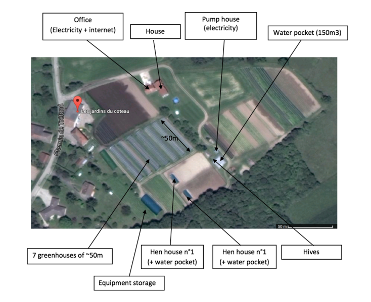
File:Jardin des Coteaux - Satellite map.png
Revision as of 18:00, 27 February 2017 by Antoine.Boisadam (talk | contribs)

Size of this preview: 734 × 599 pixels. Other resolutions: 294 × 240 pixels | 1,100 × 898 pixels.
Original file (1,100 × 898 pixels, file size: 939 KB, MIME type: image/png)
File history
Click on a date/time to view the file as it appeared at that time.
| Date/Time | Thumbnail | Dimensions | User | Comment | |
|---|---|---|---|---|---|
| current | 18:00, 27 February 2017 | | 1,100 × 898 (939 KB) | Antoine.Boisadam (talk | contribs) |
You cannot overwrite this file.
File usage
The following page uses this file: