Difference between revisions of "IndoorGeoloc2016"
| Line 1: | Line 1: | ||
| + | RICM4 Polytech Grenoble project in Geolocalisation Indoor using geolocating technologies Balises (beacon) BLE Apple [[iBeacon]] & [[AltBeacon]] |
||
| − | Technologies de géolocalisation indoor |
||
| − | Balises (beacon) BLE Apple [[iBeacon]] & [[AltBeacon]] |
||
= Preambule = |
= Preambule = |
||
Revision as of 10:19, 6 April 2016
RICM4 Polytech Grenoble project in Geolocalisation Indoor using geolocating technologies Balises (beacon) BLE Apple iBeacon & AltBeacon
Preambule
Project presentation
Nowadays, geolocalisation has become a wide spread technology. It is used in order to guide a user from a first point A to another point B, naming it can allow users to have routing help during a travel, such as driving trip or even going to a coffee. In this way, geolocalisation is incredibly well spread outdoor, it's in this case that geolocalisation is the most efficient. But, what about indoor geolocalisation ? Because of the use of satellites and GSM networks to locate an object, it is a harder to use it indoor. Buildings prevent signals to enter making impossible to locate things with those means. And this where our project takes place !
Material
- Android cellphones
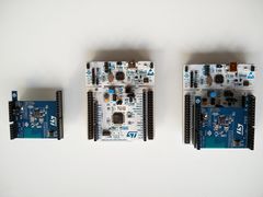
- STM32 Nucleo equiped with shield BLE X-NUCLEO-IDB04A1
- 3 iTag
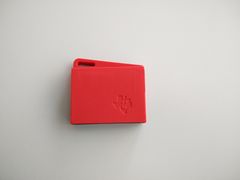
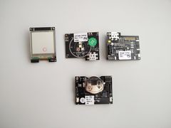
- Texas Instrument SimpleLink Multi-Standard SensorTag development kit
Team
This project is directed by Didier Donsez and designed by Diana Stoian, Quentin Faure, Damien Crastes de Paulet (team leader), Imad-Seddik Arrada. The four of us are currently studying in their first year of Polytech master degree. The project is part of the Software Development course.
Summary
The main goal of the project is to enable people to locate things (objects or people) indoor. Thanks to better fitting technologies in this context, it is now possible to obtain a precise location of an object. Using Bluetooth Low Energy technology, objects are located indoor with micro controllers placed in different corners all over the building. Those micro controllers then transmit the data concerning the object to a server which will transform them in order to display them on an OpenStreetMap map.
Liens
- Beacons, 22 utilisations hors magasin à connaître avant 2015
- VT2015 Geolocalisation Indoor
- Enzo Molion, Stage d'excellence, Université Joseph Fourier, 2015
- IEEE Registar https://standards.ieee.org/develop/regauth/
- IBeacon location research https://github.com/jpias/beacon-pfilter-simulation/wiki


